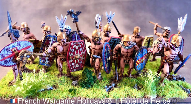
Another unit off the table the final naked unit, now to complete some more plaid!
Cheers
Matt
Showing posts with label Gaulois. Show all posts
Showing posts with label Gaulois. Show all posts
Thursday, March 26, 2020
Auluerci Diablintes tribesmen IX
Labels:
Ancients,
Diablintes,
Gaulois,
IMPETUS,
Victrix
Location:
19 Place Cheverus, 53100 Mayenne, France
Thursday, February 27, 2020
Gallic disorder markers
An addition I always like to add for my games as I build a army, disorder markers and dead casualty markers. I must have several hundred shields from different armies plus a lot of transfers for them. Getting sick of plaid and eyes again so I knocked these up yesterday as a little break from detail work, a nice addition to the table. More coming from different periods, now I need more round bases!
Cheers
Matt
Cheers
Matt
Location:
19 Place Cheverus, 53100 Mayenne, France
Monday, February 17, 2020
Gaullic Oppidum Moulay
Gallic Oppidum
In the 1970s, the first archaeological investigations revealed the Gallic origin of the Oppidum and of the defensive works, it was long considered a Roman military fortification and was called "Caesar's camp". The inner defensive wall is over 500m long only 350m of the 10 meter high rampart survives,
Along with traces of the Pincer gates. A secondary rampart in dry stone has also been recognized on the rest of the perimeter of the site at the top of the cliffs facing the Aaron and Mayenne Rivers. U
Map of Western Gaul
Artists impression of a Pincer gate
The surviving ramparts are 6-8m high and 350m of the walls are walkable, a remarkable piece of military engineering work.
The road cuts through the outer ramparts in two locations on the entrance to the village of Moulay
From the top of lookout Rock on the junction and the ford of the Mayenne and L'Aaron rivers.
Lookout Rock, on the junction of the Mayenne and the L'Aaron River
Looking back up from the river Mayenne to the Gallic city
The archeology corresponds to a Gallic domestic occupation from the 2nd century BC until the 1st AD: pottery, grain millstones, wine amphorae imported from Italy, ornaments, and the practice of metallurgical activities: bronze mold and slag.
In 2004, as part of the motorway bypass of the municipalities of Moulay and Mayenne, Inrap carried out an archaeological diagnosis over almost 9 kilometers. The road project passes less than 300 meters east of the known Gallic fortification, following the rocky promontory. Outside the enclosure, the diagnosis revealed numerous indications of the period of the final Tene (II e and I st century BC), a new rampart of about 1,200 meters long in 1000 meters upstream from the first. It joins the Mayenne and Aron valleys in a straight line. This new defensive line considerably changes the morphology of the site: the area defined by the two concentric enclosures then borders on 135 hectares.
The inner fortification and the outer fortifications marked in red.
Full expansion of the city, the gray section is the excavations by the archaeological team before the motorway construction.
Territory of the Aulerci Diablintes
It is the largest site known today on the Armorican Massif, the fortified agglomeration corresponds to the capital of the Gallic city of Diablintes. During the Roman period, the center of power moved a few kilometers from there to Jublains (Noviodunum), where the city remained until the early 5th century, before returning to Mayenne under the Carolingians, when the chateau was built.
Labels:
Celts,
Diablintes,
Gaulois,
Wargame Tours
Location:
19 Place Cheverus, 53100 Mayenne, France
Friday, January 31, 2020
Aulerci Diablintes tribesmen V
Off the desk this week some of the first clothed Aulerci Diablintes, quite happy with my plaid on these, two more units not far behind.
Labels:
Ancients,
Diablintes,
Gaulois,
IMPETUS
Location:
19 Place Cheverus, 53100 Mayenne, France
Subscribe to:
Comments (Atom)


